")


Introduction
Bathymetry is a discipline of oceanography and geodesy that deals with the measurement of depths and the cartographic representation of the seabed. Bathymetric surveys are therefore carried out to understand the morphological trend of the sea and lake bottom. They are necessary for the design and monitoring of maritime and river works, in dredging and nourishment and in coastal erosion studies.Instrumentation
Oceanografic boat
The research vessel “Antonino Borzì” from University of Palermo (UNIPA) is equipped with devices which allow to perform bathymetric surveys with great accuracy, either in deep and shallow waters and also to define the nature of the surveyed sea bottom. The combined use of the “Multibeam Echo Sounder (MBSE) and the “Side Scan Sonar (SSS)” allows high-resolution acoustic surveys as required by the MARE project. Within the project, such surveys have a twofold objective: i) reconstruct the morphology of the sea bed in order to model both marine current and sea waves; ii) recognize the sites suitable for the installation of energy plants in function of morphology and nature of the sea bottom.
For the surveys, morphometric and bathymetric are acquired simultaneously by SSS and MBES, thus ensuring total coverage of the seabed. The vessel is equipped with an RTK-GPS system and navigation system that provided positioning data (centimetric accuracy) and altitude data (0.001◦ accuracy) to the navigation and to the acquisition systems.
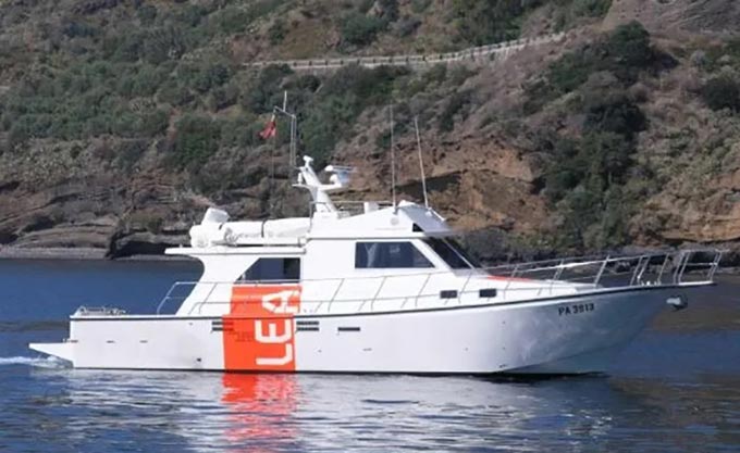
The research boat "Antonino Borzì" of the University of Palermo is a research boat capable of operating in the fields of marine geophysics and geochemistry, even near the coast line, or in shallow waters. The "Antonino Borzì" is equipped with advanced acoustic systems for the execution of bathy-morphological surveys and the creation of high-resolution thematic maps of the seabed