")


At the heart of the MARE project, seismic data analysis takes a novel approach to understanding the energy of the sea. Instead of relying solely on traditional wave buoys or radar measurements, we harness the subtle vibrations that ocean waves generate in the Earth itself. These tiny ground motions, often imperceptible to humans, carry a wealth of information about the state of the sea.
Our method begins with continuous data collection from a network of strategically placed seismic stations along the coast and islands. Each station records ground vibrations in a wide range of frequencies, capturing signals from both local waves and distant storms. This continuous monitoring provides an uninterrupted picture of the ocean’s rhythm, day and night, through calm weather or storms. By examining the distribution of energy across different frequencies through methods such as Power Spectral Density (PSD), we can isolate the portion of the signal generated by waves. This allows us to filter out unrelated seismic noise and focus on the patterns that reveal the ocean’s dynamics.
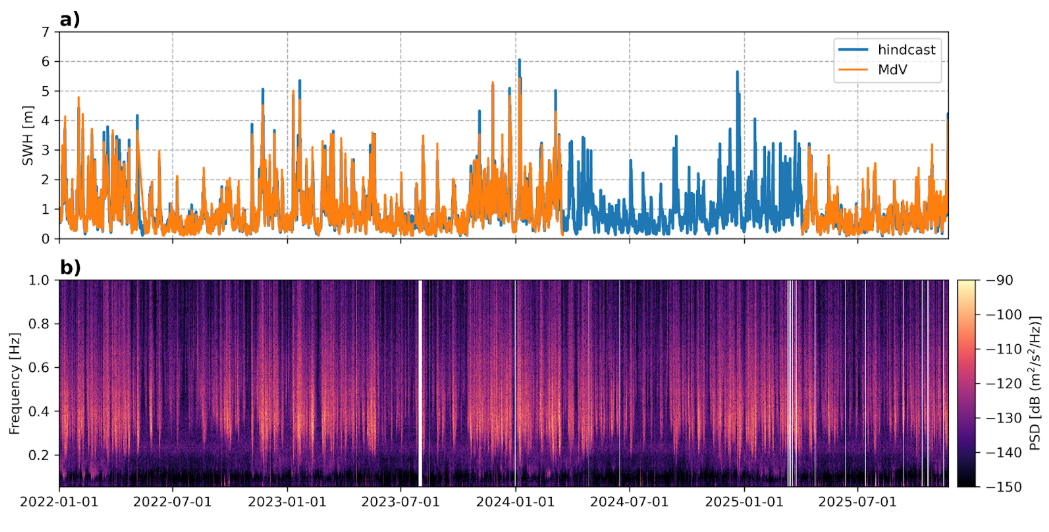
Figure 1. Sea state signature on seismic data. a) Observed significant wave height (SWH) at the oceanographic buoy of Mazara del Vallo (MdV), together with SWH time series from a hindcast model at the closest grid point to the location of MdV. b) PSD of vertical component as a function of time (spectrogram) for station CAVT in the frequency range 0.05-1 Hz.
The next step is to estimate the parameters of ocean waves from seismic data. Using the processed seismic signals, we can infer key sea state variables such as significant wave height (SWH), wave period, and the energy carried by the waves. These estimates form the foundation for understanding how much energy the sea holds in any given location and moment.
Finally, we integrate this information with advanced modeling and artificial intelligence. By combining seismic-derived data with high-resolution wave models, our AI algorithms produce detailed maps of the sea state and energy potential. These predictive maps not only provide real-time monitoring but also enable forecasting, offering a powerful tool for planning sustainable energy extraction and supporting maritime safety.
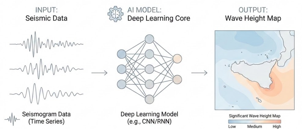
Figure 2. Conceptual workflow of the MARE approach: continuous seismic recordings from coastal and island stations are processed using deep learning techniques to extract patterns related to ocean wave dynamics, enabling the reconstruction of high-resolution maps of significant wave height over the Sicily region.