")


Bathymetric investigations within the MARE project focus on accurately characterizing the morphology of the seabed in the Egadi Islands area. Understanding underwater topography is essential for interpreting ocean dynamics, improving numerical simulations, and assessing marine energy potential.
The methodology is based on systematic bathymetric surveys carried out using high-precision acoustic instruments, such as multi-beam echo sounders. These systems measure water depth by emitting acoustic pulses toward the seabed and recording the returning signal. When combined with accurate positioning systems (e.g., high-precision GPS), this approach allows the construction of detailed depth profiles across the study area.
A dedicated high-resolution bathymetric and water-column survey was carried out aboard the research vessel Nautilus using a Norbit Winghead i77h Multibeam Echo Sounder. Survey lines were planned with ~75 m spacing and 25% overlap to ensure full seafloor coverage. Vessel speed was maintained at ~3 knots to optimize data quality.
The survey focused in particular on the offshore sector of Levanzo Island, where previously mapped dune fields were re-investigated.
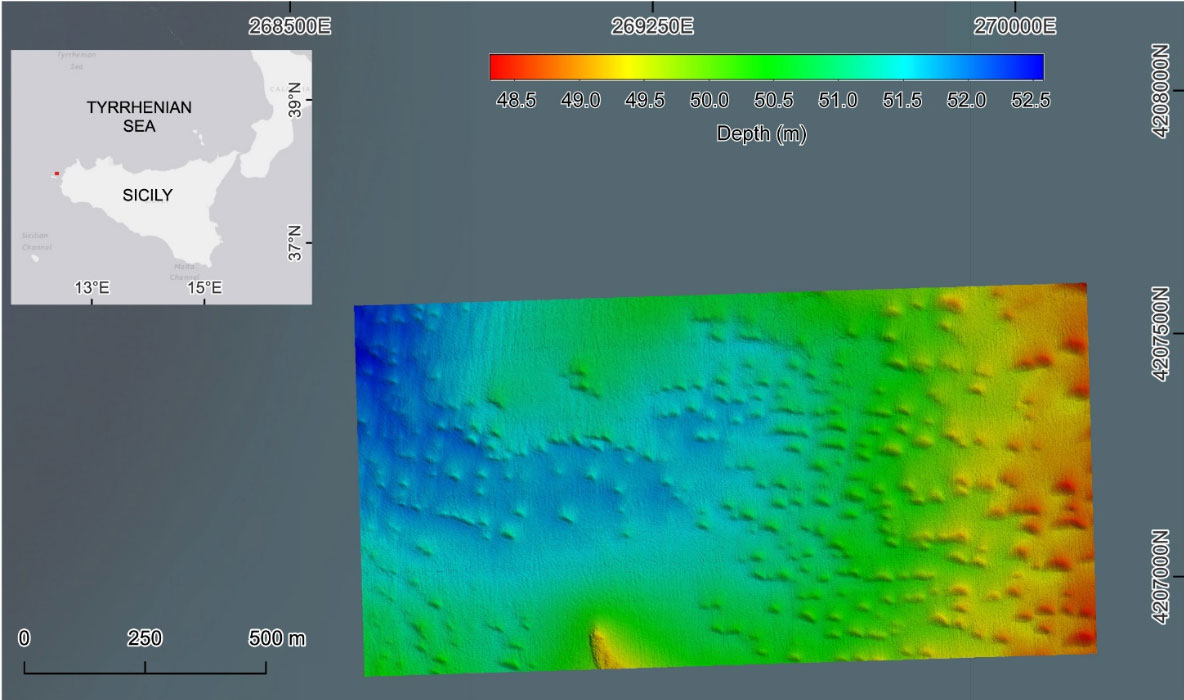
Figure. 1: multibeam survey of the submarine dune field southeast of Levanzo Island at a depth of approximately –50 m (false-color image).